What Does a Head Surveyor Do in the Revenue Department? - Roles, Duties & Importance Explained
Know the duties of a Head Surveyor in the Revenue Dept—land surveys, patta help, disputes & more explained clearly for land buyers.
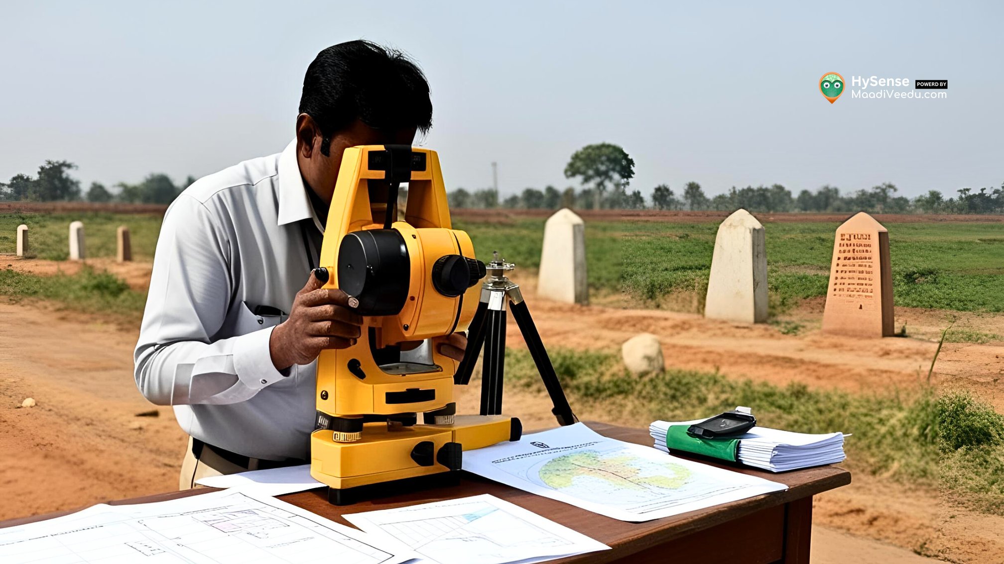
Table of Contents
Understanding land ownership, boundaries, and disputes starts with one key role in the Revenue Department — the Head Surveyor. This expert ensures that land records are accurate, legal rights are protected, and disputes are resolved fairly.
In this blog, you'll learn in simple language what a Head Surveyor does, why their work is important for landowners, and how it affects property transactions and land tax.
Looking for land with verified survey details and clear boundaries? Start here
Who is a Head Surveyor?
A Head Surveyor is a senior government officer in the Revenue Department. They supervise land measurement, update official land records, manage junior staff, and resolve land boundary disputes.
Their job ensures that land is properly documented, helping both landowners and government offices make informed decisions.
Key Responsibilities of a Head Surveyor
1. Land Measurement
The Head Surveyor supervises survey teams that physically measure plots using tools like GPS, Total Stations, and traditional chains. Accurate land measurements are the base for all land records.
2. Marking Boundaries
When there’s confusion over where one plot ends and another begins, the Head Surveyor’s job is to fix the boundaries and mark them on the ground. This helps avoid fights between neighbors or family members over land.
3. Updating Land Records
After any sale, gift, inheritance, or partition, the Head Surveyor updates the revenue records. This includes recording new survey numbers or sub-divisions in official registers.
4. Resolving Land Disputes
Land disputes are common in rural and urban areas. A Head Surveyor’s report is often used in legal cases or by Tahsildars and other officials to solve these problems.
5. Managing Field Staff
The Head Surveyor leads junior surveyors, village assistants, and technical staff. They ensure all surveying tasks are done with accuracy and within the given timeline.
6. Preparing Survey Maps and Reports
Survey maps prepared by the Head Surveyor help with issuing patta, chitta, and FMB (Field Measurement Book) records. These are essential for land transactions, registrations, and loans.
Tools Used by Head Surveyors
To ensure accuracy, they use modern tools like:
- GPS Devices – For satellite-based location marking
- Total Station – A digital surveying tool for angle and distance measurement
- Theodolites & Measuring Tapes – Used in traditional surveys
- Drones (in some states) – For aerial mapping in large or difficult lands
- GIS Software – To store, update, and analyze land maps digitally
Importance of a Head Surveyor in Land Ownership
🟢 Prevents land disputes through proper boundary marking
🟢 Supports land registration by issuing accurate survey documents
🟢 Enables legal land transfers by maintaining up-to-date records
🟢 Ensures fair land tax calculation based on correct land size
🟢 Helps in government schemes such as housing, road development, or compensation
Real-Life Example (Practical Case)
In a village near Coimbatore, two families fought over a 10-cent plot for years. The matter reached the local Tahsildar. The Head Surveyor visited the spot, re-measured the land using a Total Station, and provided a report. Based on this, the Tahsildar issued final orders and resolved the dispute peacefully. This shows how important the Head Surveyor’s role is in the real world.
How to Become a Head Surveyor?
✅ Educational Qualification
- Diploma or Degree in Civil Engineering / Surveying / Geomatics
- Certificate course in land surveying (in some states)
✅ Experience & Promotion
- Usually promoted from Junior Surveyor after 8–10 years of service
- Must complete government training in land laws, GIS mapping, and property records
Common Challenges Faced
- Outdated Records – Many villages still use old paper records needing digital updates
- Public Disputes – Land disputes often involve emotional or legal complexities
- Difficult Terrain – Surveying in hilly or forest areas is physically challenging
- Technology Training – Staff must be trained regularly on modern equipment
Frequently Asked Questions (FAQs)
1: Can a Head Surveyor help me if my neighbor encroaches on my land?
Yes. You can approach the Taluk Office and request a re-survey. The Head Surveyor will conduct a boundary check and file a report.
2: How much time does a land survey take?
It depends on the land size and location. Small plots can be surveyed in 1 day; larger areas may take longer.
3: Do I need a Head Surveyor’s report for Patta transfer?
In most cases, yes — especially if boundaries are unclear or changes have been made.
4: Is there any fee for land surveying?
Yes. Government surveys have nominal charges. Private landowners can also request paid surveys for urgent cases.
5: Where can I find my land's survey number and map?
Visit your local Revenue Office or check your state’s online land records portal (like Dharani, TN e-Services, etc.).
Conclusion
The Head Surveyor is the backbone of accurate land records and fair land dealings. Whether it’s for buying land, resolving a dispute, or applying for a patta, their role ensures everything is done legally and clearly.
If you are planning to buy, sell, or check any property details, make sure survey records are up-to-date and verified by the Revenue Department.
Need Land or Property Help?
Explore verified property listings, farmland, and residential plots at
For more real estate tips, visit 👉 blog.maadiveedu.com